
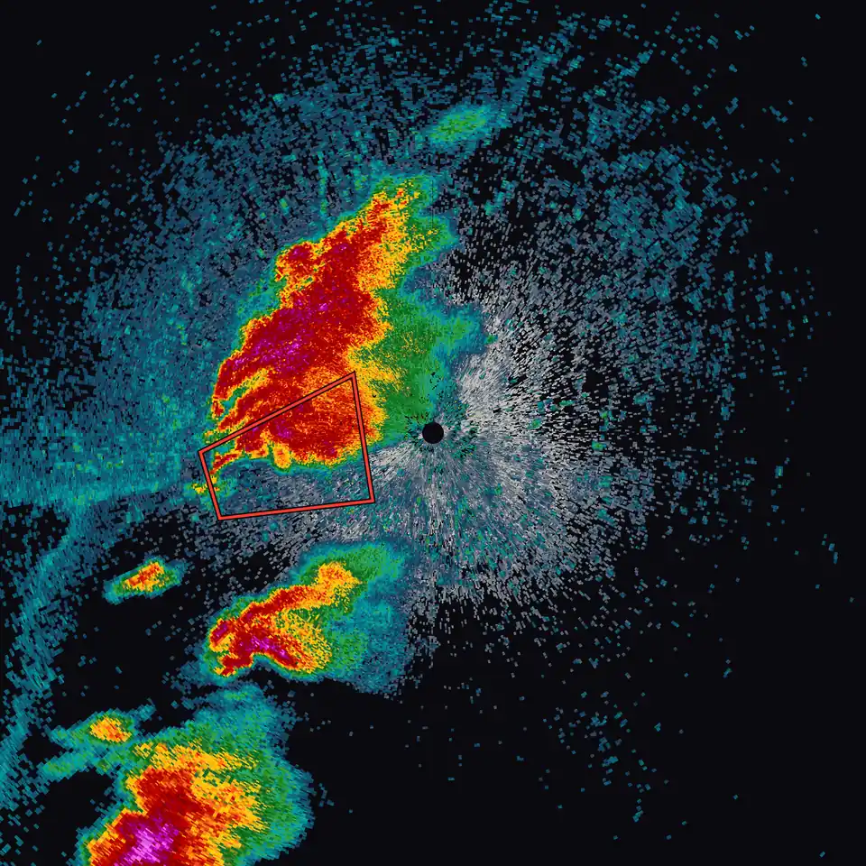
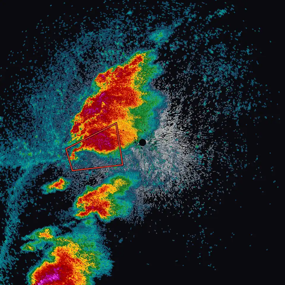
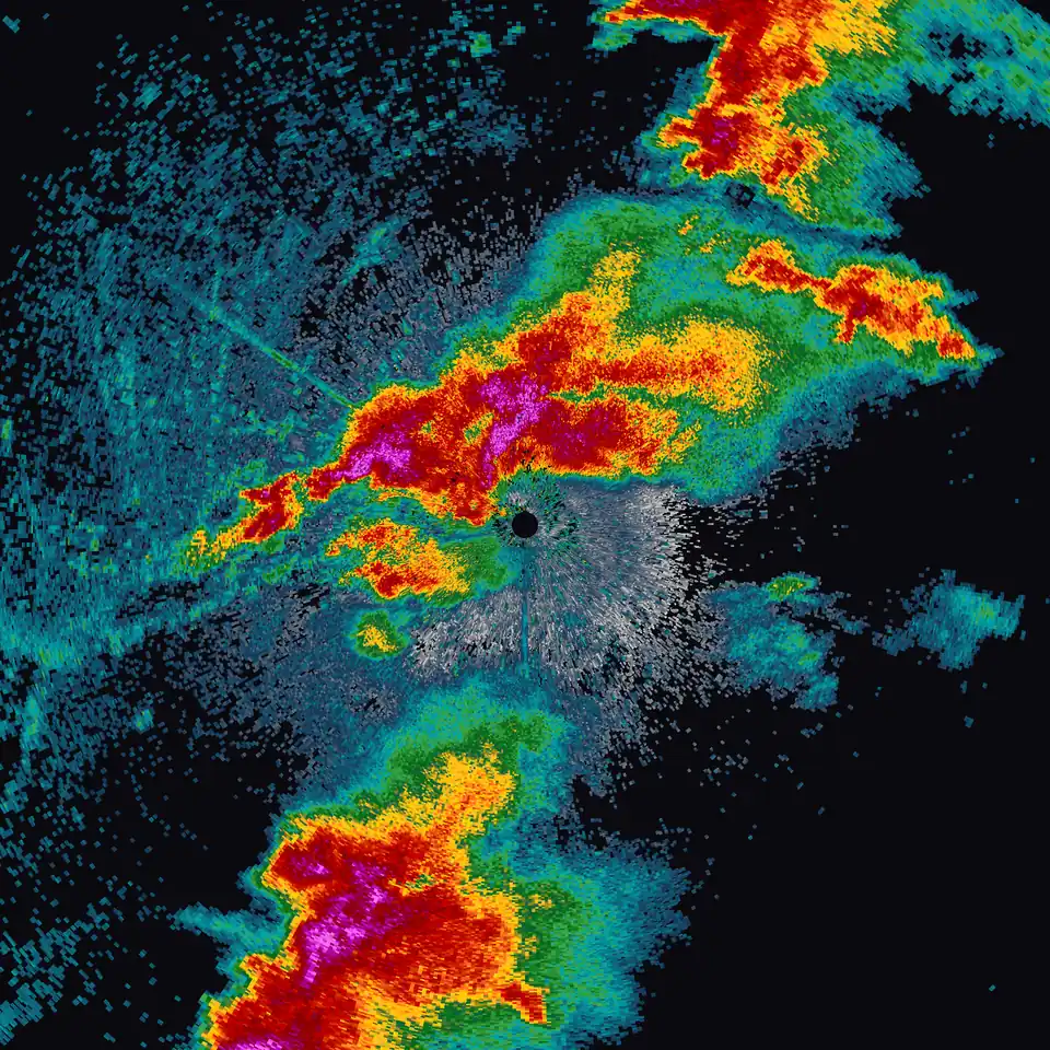
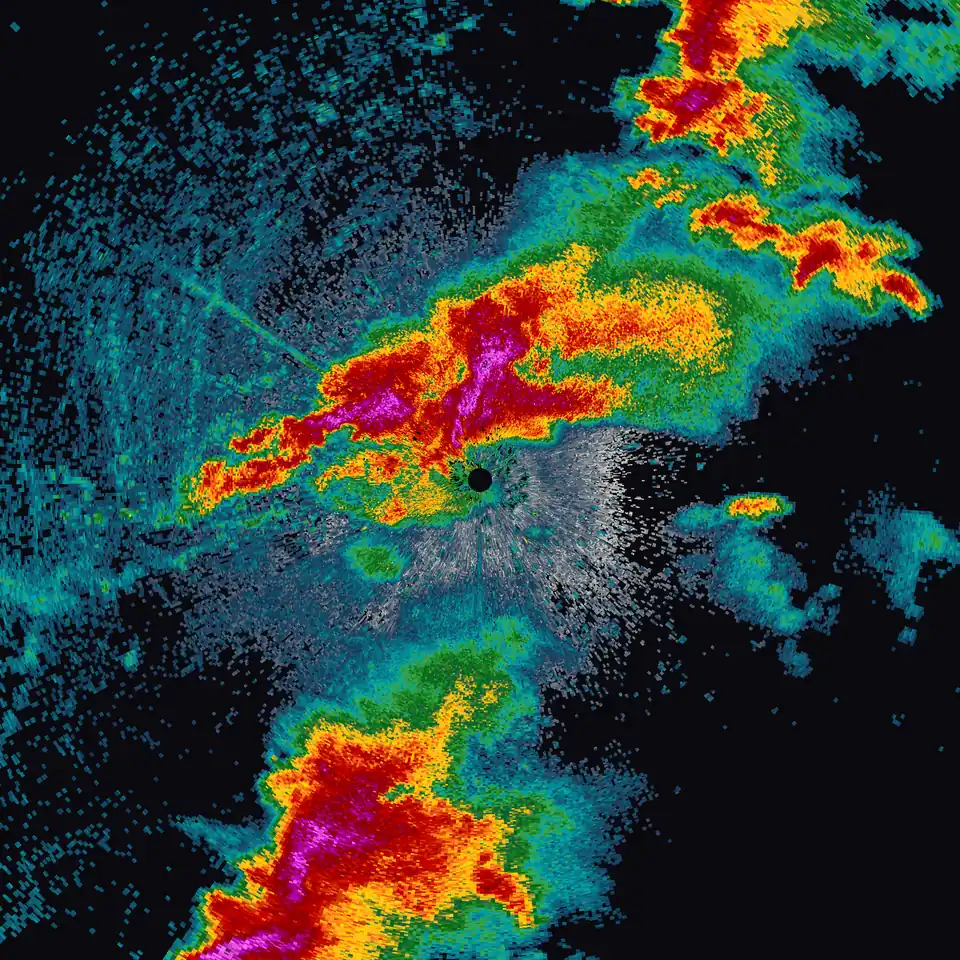
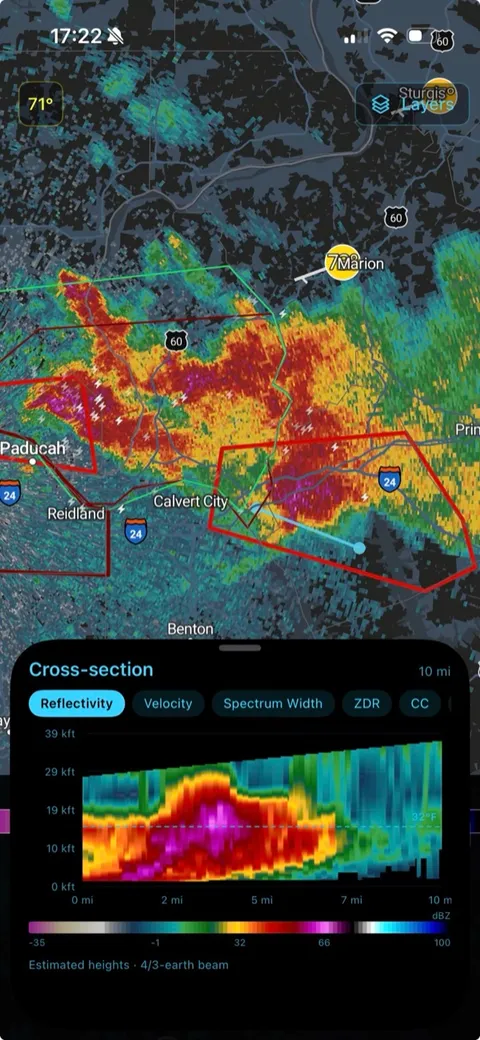
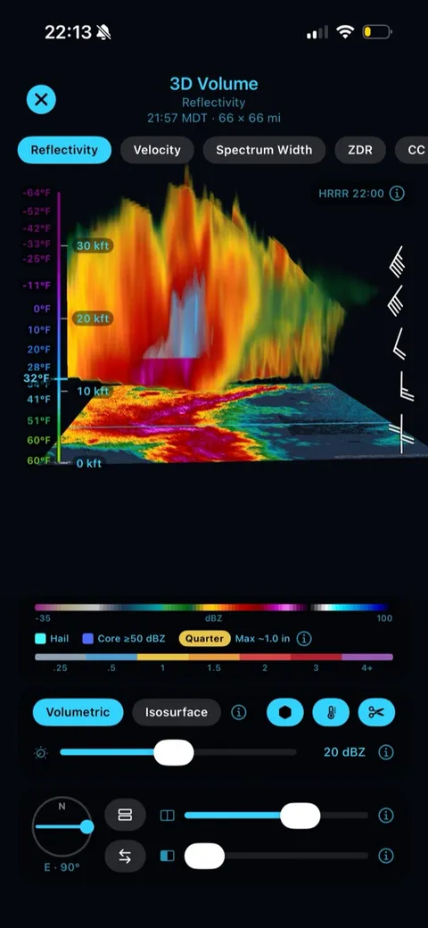
Inside the storm.
Storm Cross-Section slices straight through the updraft to show hail lofted above the freezing level, and 3D Storm Volume turns the same scan into a rotatable scene you can walk around. Premium
Watch the radar turn.
LIVE Sweep streams each ray the moment the radar collects it. The beam sweeps around and paints the storm arc by arc, turning at the radar's real rotation rate, on any Level 2 product and any tilt, at every NEXRAD radar. Premium
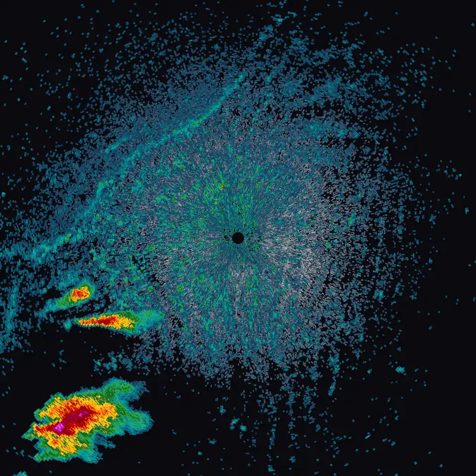
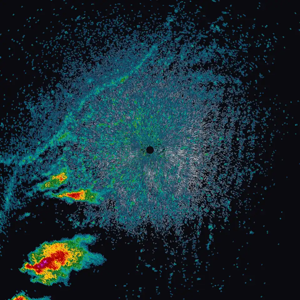
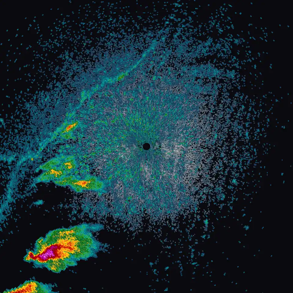
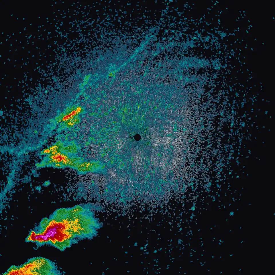
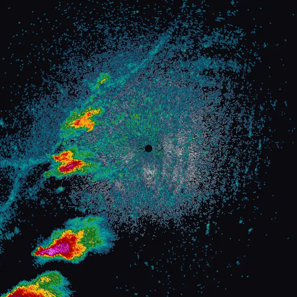
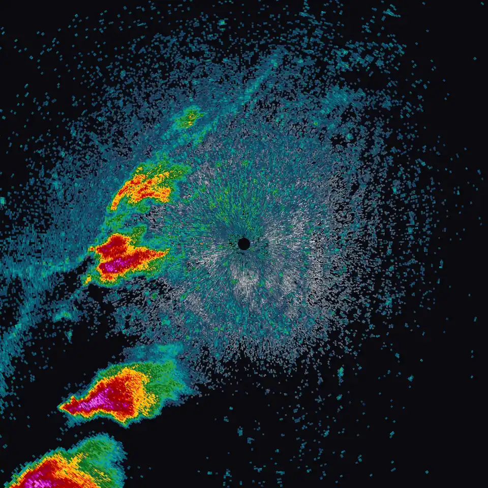
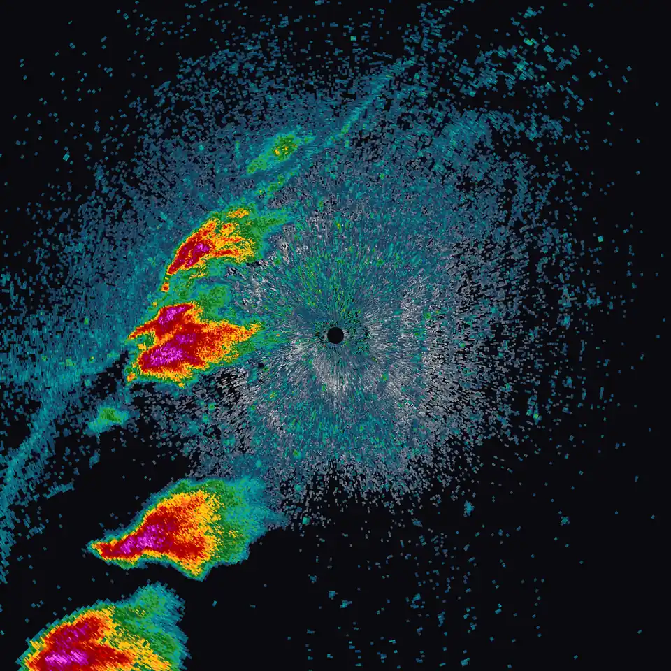
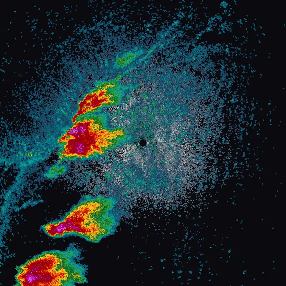
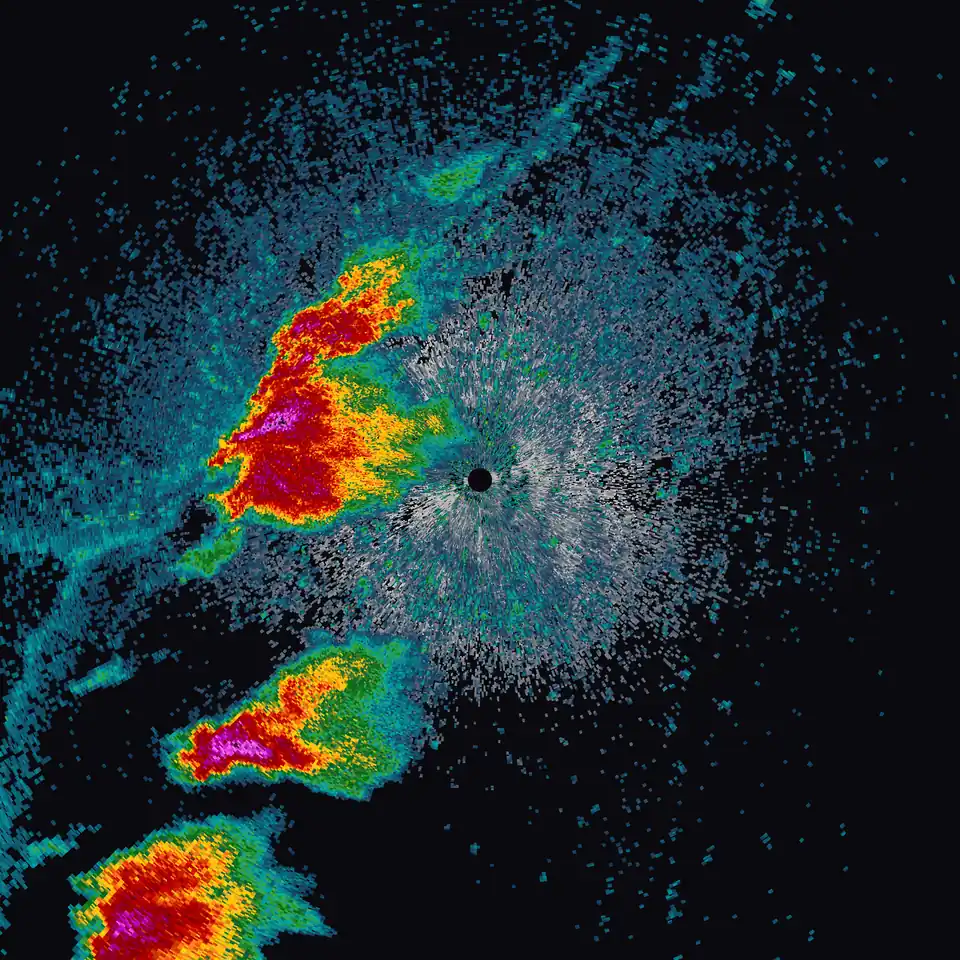
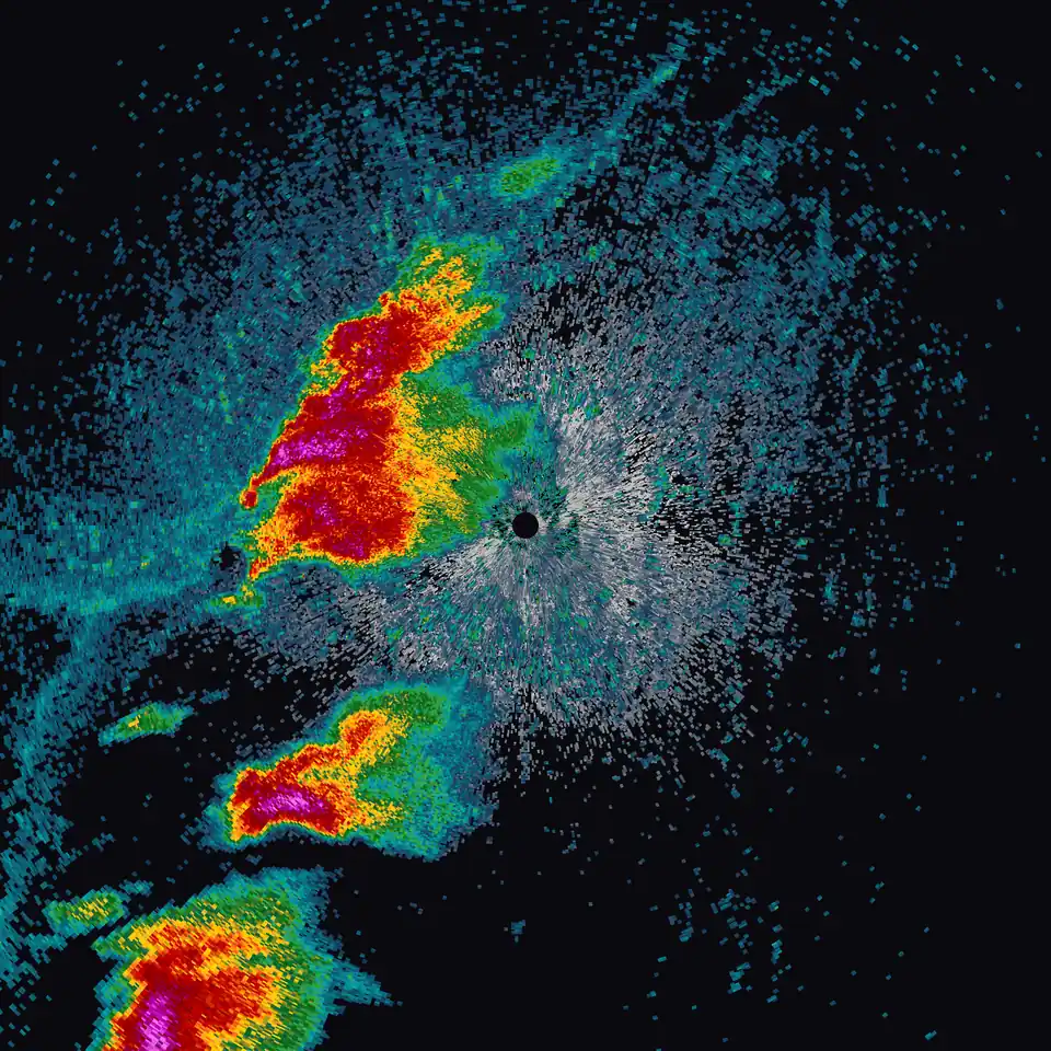
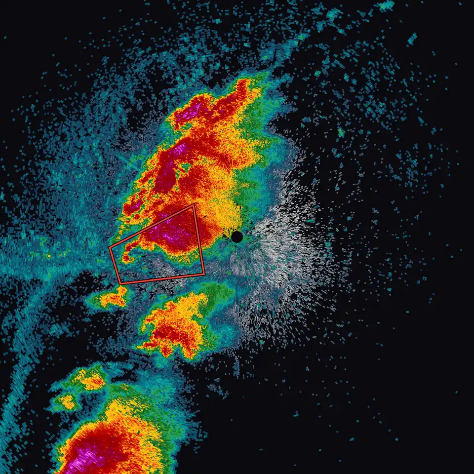
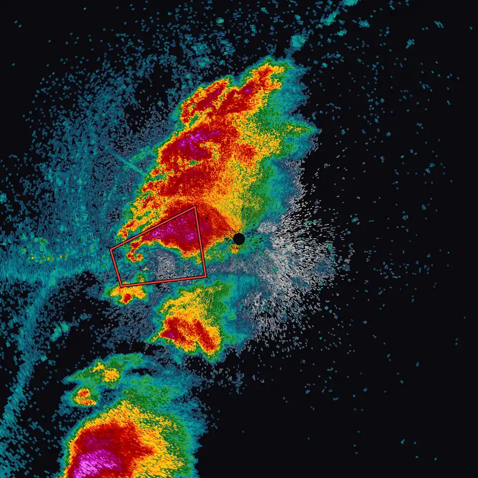
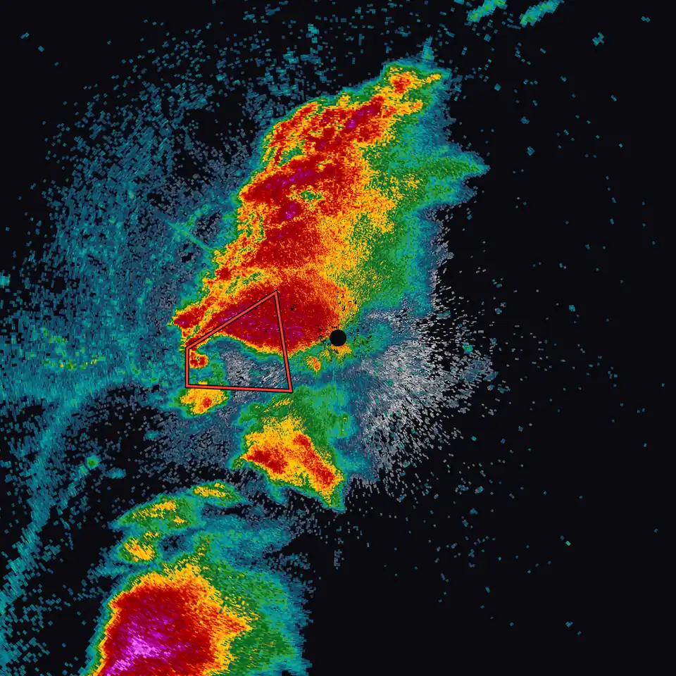
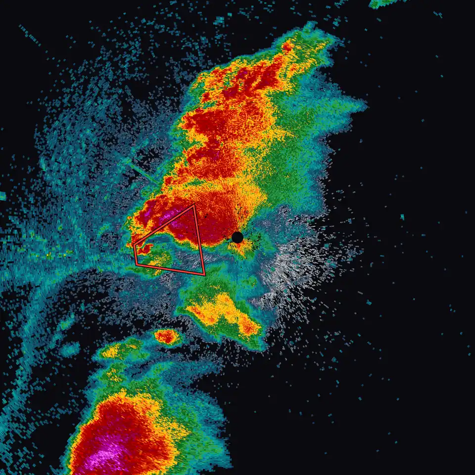
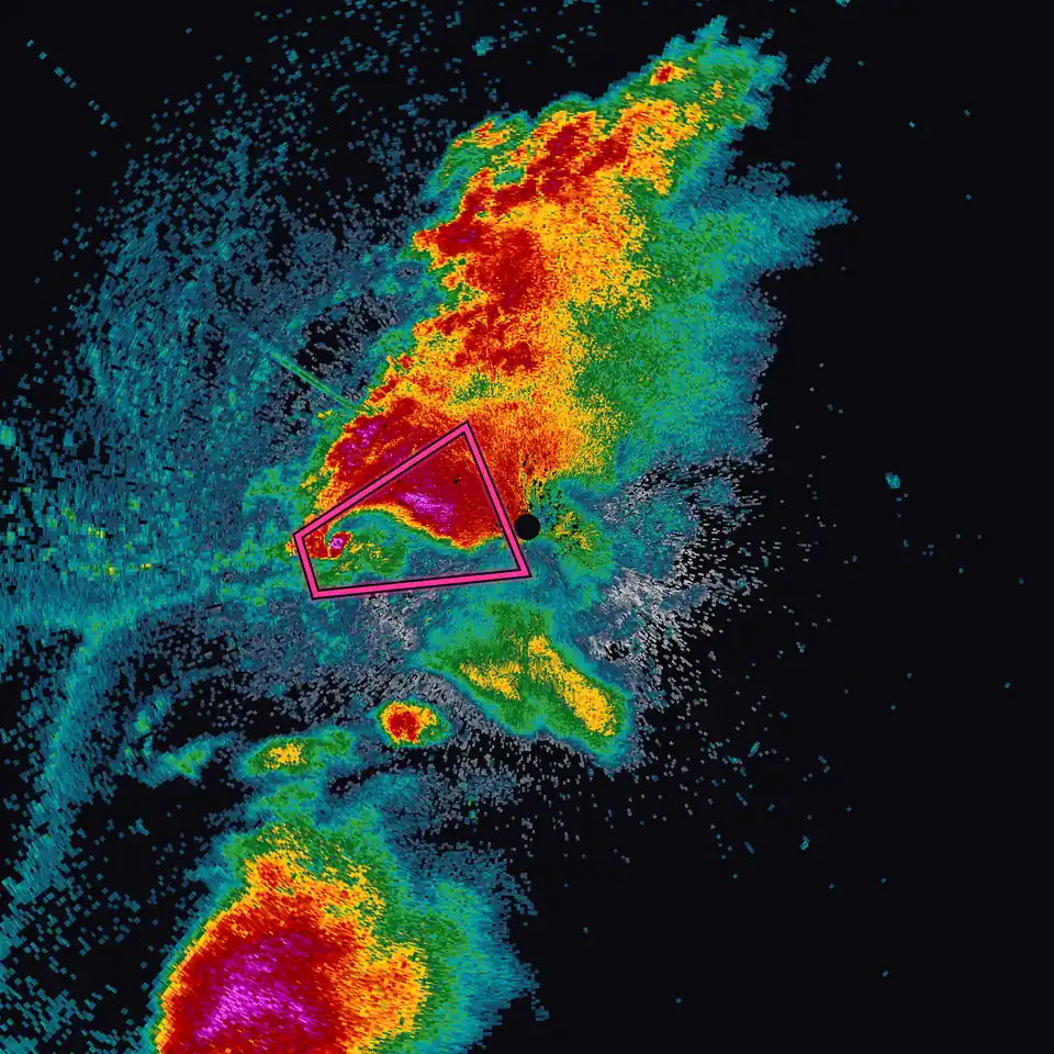
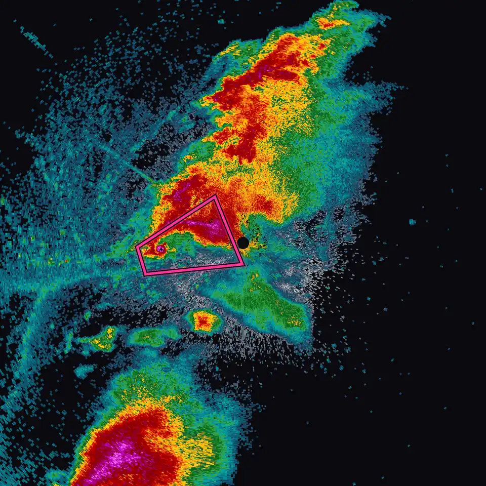
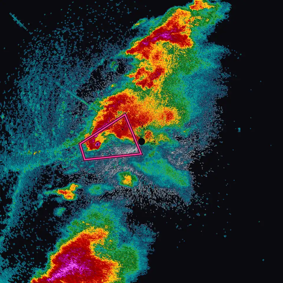
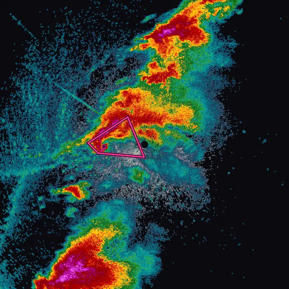
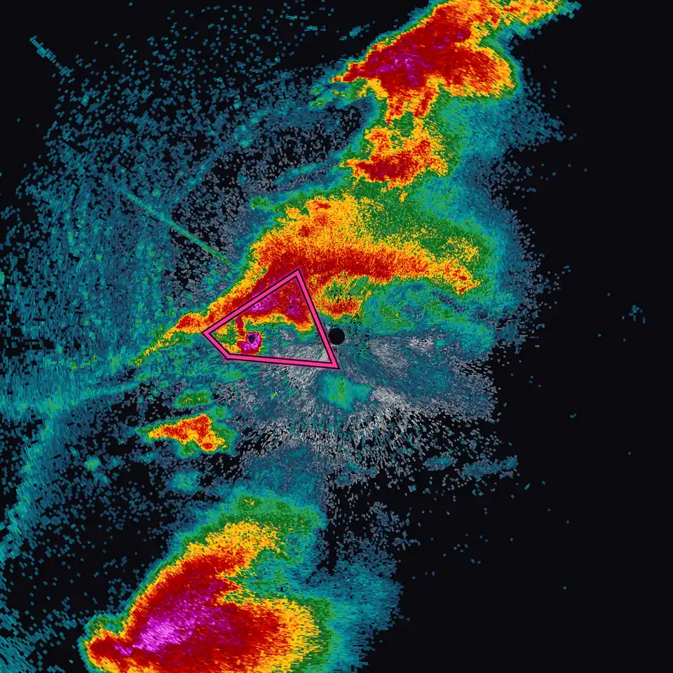
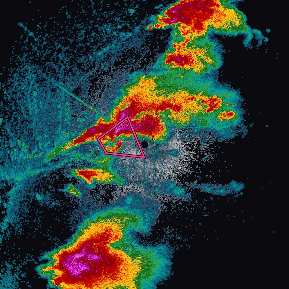
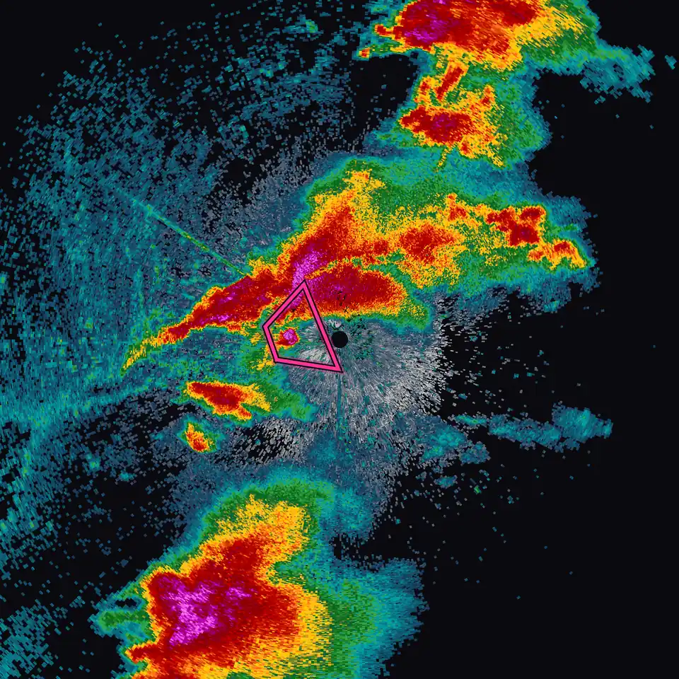
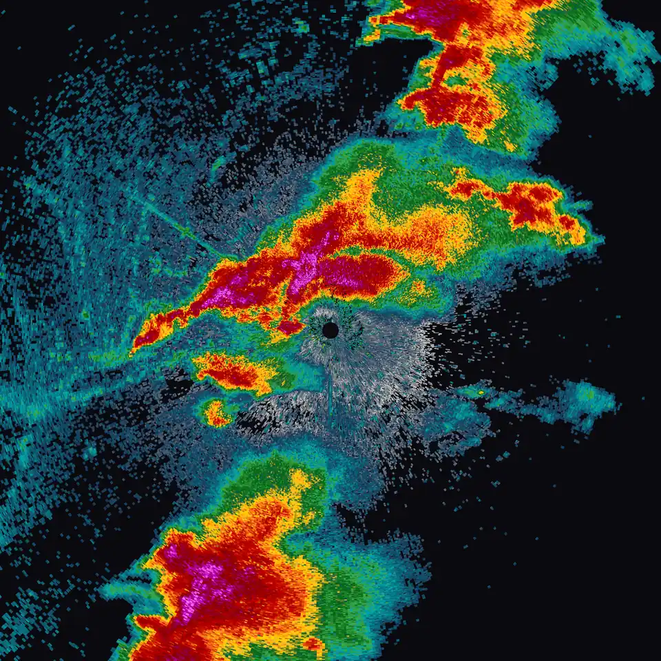
Replay any storm since 1991.
Every frame on this page, from first echo to hook, came from the historical radar archive in Echoes: raw NEXRAD data back to 1991. Premium
Moore had been here before. May 3, 1999, replayed in Echoes.
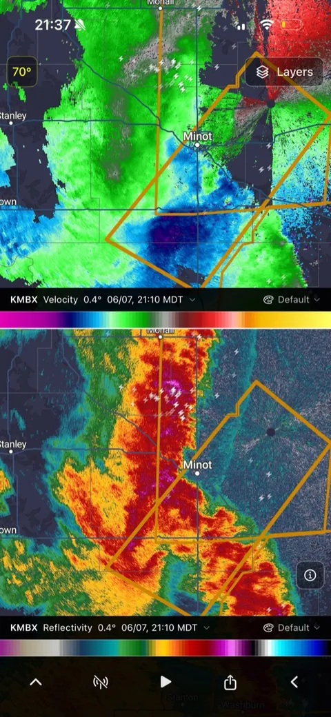
Side by side.
In velocity data, rotation is unmistakable: winds toward the radar beside winds away from it. Dual Products puts reflectivity and velocity on one synced map, so the couplet shows up right next to the shape that caused it. Premium
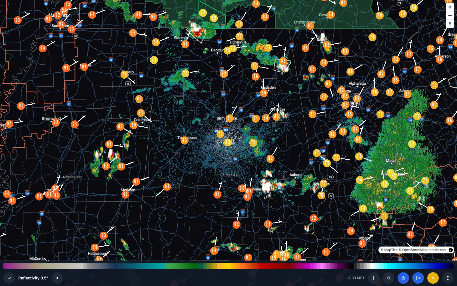
Not every storm is a tornado.
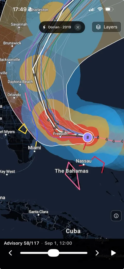
Hurricane Tracking
Track every NHC storm live: the official forecast cone, watches and warnings, and full NHC bulletins, free for everyone. Premium adds Tropical Guidance with multi-model spaghetti tracks, wind speed probabilities, and every Atlantic storm back to 1851.
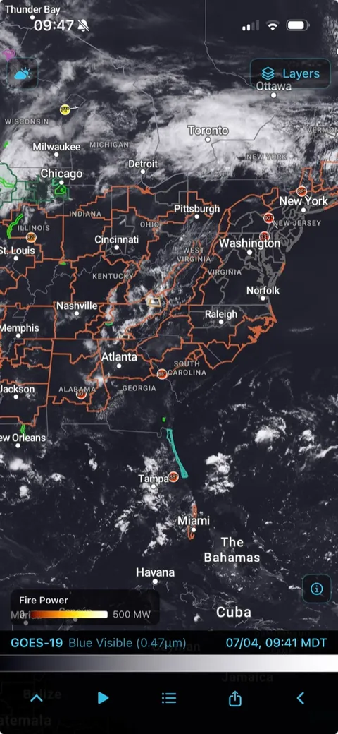
GOES East + West Satellite
36 satellite products including visible, infrared, water vapor, and stability indices, with live fire detection overlaid on the imagery. GOES-19 (East) and GOES-18 (West) coverage across Pacific, CONUS, and Atlantic regions. Premium
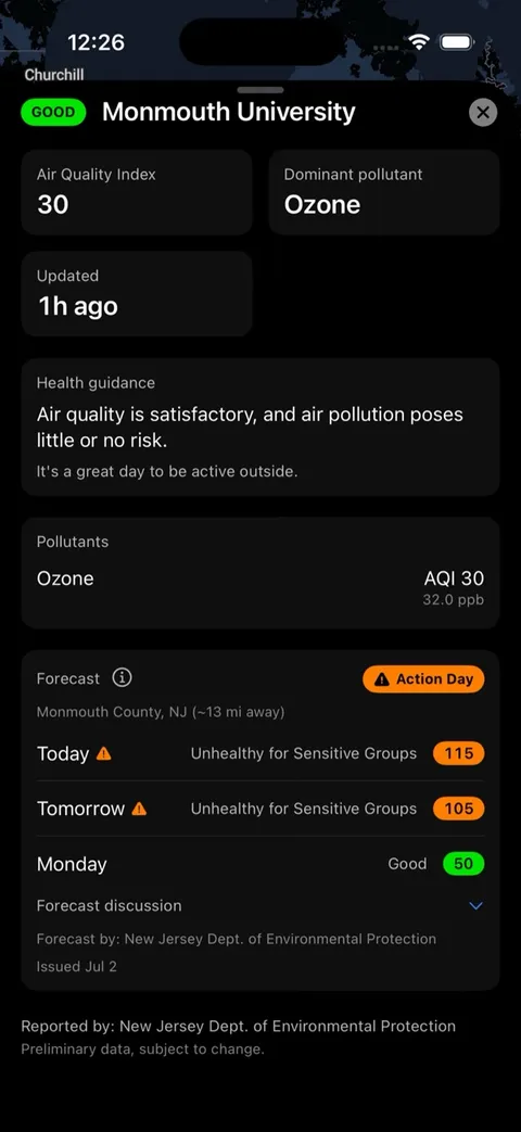
Air Quality
Real-time EPA air quality for thousands of monitoring sites, color-coded by category with per-pollutant detail and health guidance. Free. Premium adds the 6-day AQI forecast with Action Day alerts.
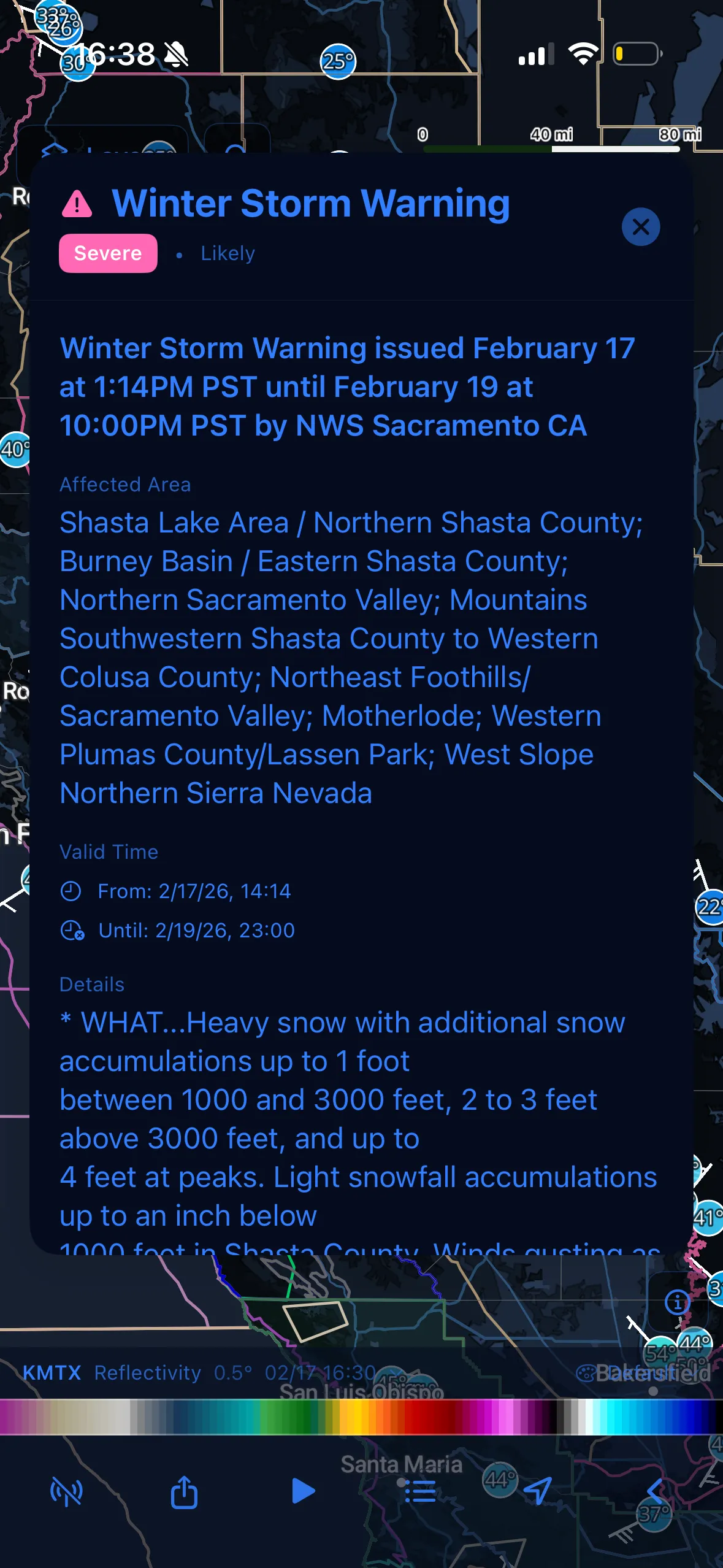
NWS Alerts
Push notifications when the NWS issues an alert for your saved locations. Full alert text and polygon overlays, from Tornado Warnings to the Winter Storm Warning shown here.
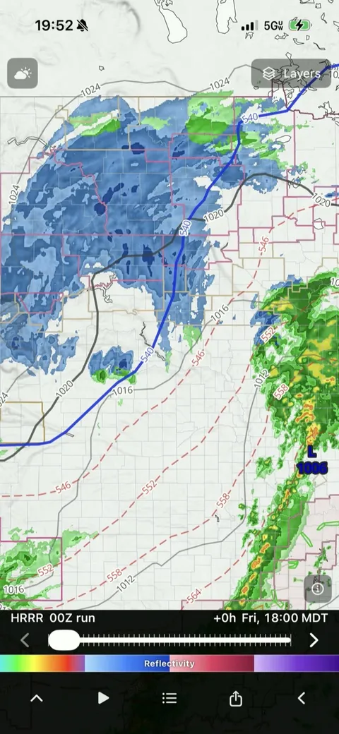
Weather Models & Soundings
12 models including HRRR, NAM, RAP, RRFS, GFS, GEFS, and IFS, with contour lines, wind barbs, and extrema overlays. Skew-T soundings with hodographs and SARS storm analogs at any location. Premium
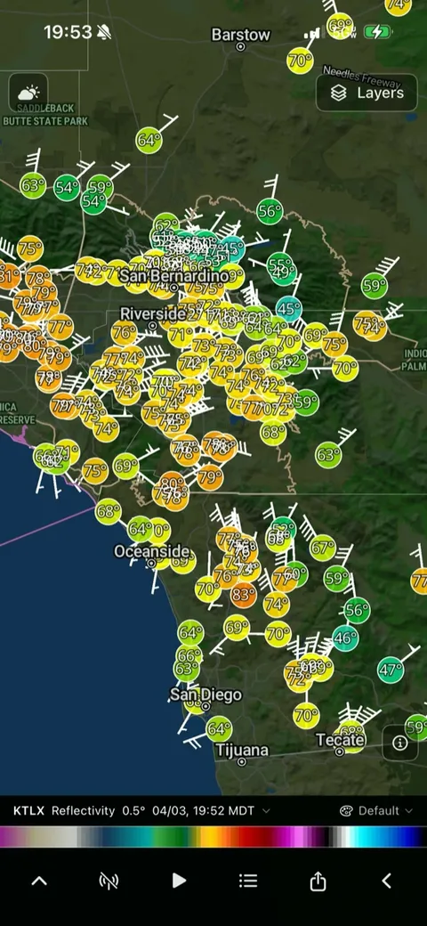
Ground Truth
28,000+ weather stations, real-time lightning, Spotter Network positions, and community storm reports. Spotter Network and community reports are free; stations charts and lightning are Premium.
See it live.
Live NEXRAD radar in your browser, with the same data and palettes as the app. No install required.
 Open Live Radar
Simple Pricing
Free
Get started with core features
- ✓ 75+ Level 2 and Level 3 radar products
- ✓ 160+ NEXRAD sites
- ✓ NWS alerts with polygons
- ✓ Push notifications for NWS alerts
- ✓ Hurricane cone, track & outlooks
- ✓ SPC outlooks
- ✓ MRMS composites
- ✓ Hourly & 10-day forecasts
Plus 9 more Show fewer +
- ✓ Convective discussions
- ✓ Area Forecast Discussions
- ✓ EPA AirNow air quality
- ✓ Flood outlooks
- ✓ Spotter Network
- ✓ Community reports
- ✓ Weather stations
- ✓ Location search & favorites, up to 3 saved locations
- ✓ 60fps animations
- ✓ Every Premium feature, nothing held back
- ✓ A full month, not a 7-day trial
- ✓ Cancel in one tap from your Apple ID
 Scan with your iPhone
to claim on the App Store
New subscribers only. Renews at $2.99/mo unless canceled.
$2.99/mo or $24.99/yr
Annual saves 30%, with a 7-day free trial
Everything in Free, plus:
- ✓ LIVE Sweep ray-by-ray radar streaming
- ✓ 3D Storm Volume
- ✓ Storm Cross-Section
- ✓ Dual Products split view
- ✓ Historical radar (1991-present)
- ✓ Tropical Guidance & 1851+ hurricane archive
- ✓ Real-time lightning
- ✓ 12 weather models
Plus 12 more Show fewer +
- ✓ AQI Forecast with Action Days
- ✓ RTMA surface analysis
- ✓ NWPS river gauges & hydrographs
- ✓ Forecast plots (meteograms)
- ✓ Skew-T soundings with SARS
- ✓ Observed RAOB soundings
- ✓ 36 GOES satellite products
- ✓ 13 alert categories & notification filters
- ✓ 28,000+ stations with 48hr charts
- ✓ Location search & favorites, up to 20 saved locations
- ✓ 52-frame animations at 60fps
- ✓ Premium map styles
Frequently Asked Questions
Is Echoes free? +
Yes. The free tier includes 75+ Level 2 and Level 3 radar products across 160+ NEXRAD sites, NWS alerts with push notifications, SPC outlooks, MRMS composites, hurricane tracking, and more. Premium adds LIVE Sweep, 3D Storm Volume, Storm Cross-Section, historical radar back to 1991, and more.
What radar data does Echoes use? +
Direct NEXRAD Level 2 and Level 3 feeds from the National Weather Service, with a new scan every 4 to 10 minutes depending on scan mode.
How far back does the historical radar archive go? +
Back to 1991, the start of the NEXRAD network. Historical radar is a Premium feature.
Does Echoes work outside the United States? +
No. Echoes is built around the NEXRAD network and NWS products, which only cover the United States.
Can I cancel my Premium subscription anytime? +
Yes. Subscriptions are managed through the App Store, and you can cancel anytime from your Apple ID settings.
Is Echoes a substitute for official weather warnings? +
No. Echoes displays official NWS warnings and forecasts. In severe weather, use more than one source of information and follow guidance from local officials.
Everything in Echoes
Radar
- NEXRAD Level 2 & Level 3 data
- LIVE Sweep ray-by-ray live streaming
- 160+ radar sites
- Dual Products split view
- Storm Cross-Section
- 3D Storm Volume
- MRMS composites
- Historical radar archive to 1991
- Custom color palette import (.pal)
Severe Weather
- NWS alerts with polygons
- Push notifications, 13 alert categories
- SPC Days 1-3 outlooks
- Mesoscale Convective Discussions
- Mesoscale Precipitation Discussions
- Spotter Network positions
- Community storm reports
Tropical
- NHC forecast cone, watches & warnings
- Formation outlooks
- Tropical Guidance spaghetti models
- Wind speed probabilities
- Atlantic storm archive to 1851
Satellite & Lightning
- GOES East & West imagery
- 36 satellite products
- Live fire detection (FDC)
- Real-time GLM lightning
Models & Soundings
- HRRR, NAM (including NAM 3km), RAP, RRFS
- GFS, GEFS, IFS, AI-enhanced forecasts
- Skew-T soundings with hodographs
- SARS storm analogs
- Observed RAOB soundings
- Meteogram time series
Surface & Water
- RTMA surface analysis
- 28,000+ weather stations
- NWPS river gauges & hydrographs
- Area Forecast Discussions
- EPA AirNow air quality, 6-day forecast
Everywhere Else
- In-app radar glossary
- Multiple map themes
- Favorites, up to 20 saved locations
- Location search
- 52-frame animations at 60fps
Claim 1 month of Premium free (redeems in the App Store, no app install needed first)
Questions, feedback, or feature requests? [email protected]